
Elevate Your Project With Precision GIS Mapping!
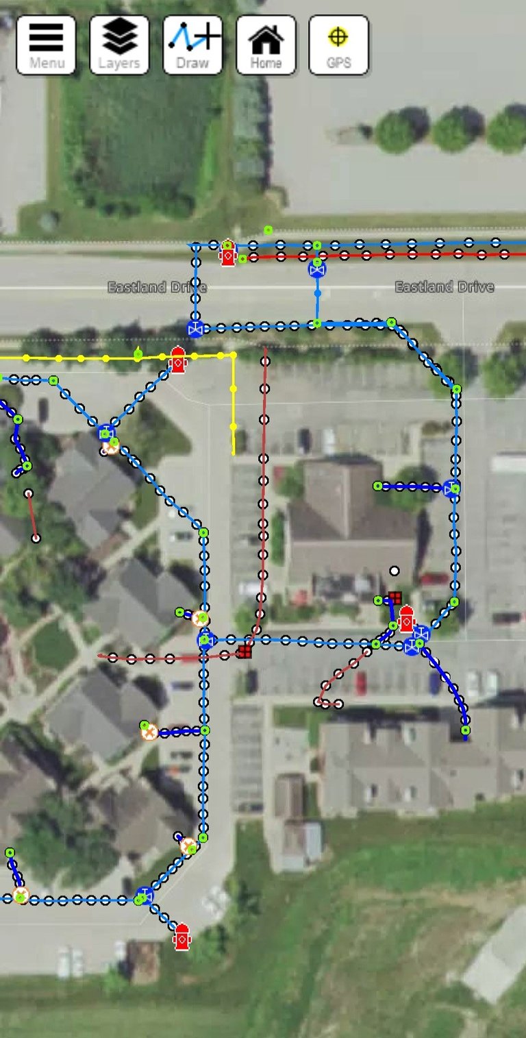
Private utility locating is just the start of what we can do at Linelock Locating. By creating a GIS map of your utilities, we give you a powerful tool that boosts safety, saves time, and makes every project run smoother — for landowners, contractors, and property managers alike.
Our GIS maps offers industry-leading RTK accuracy, ensuring precise utility locations. Plus, our user-friendly mapping software makes navigation simple and intuitive, empowering you to make informed decisions with ease.

Advantages of GIS Mapping
Our maps are viewable on
your phone, tablet, and desktop!
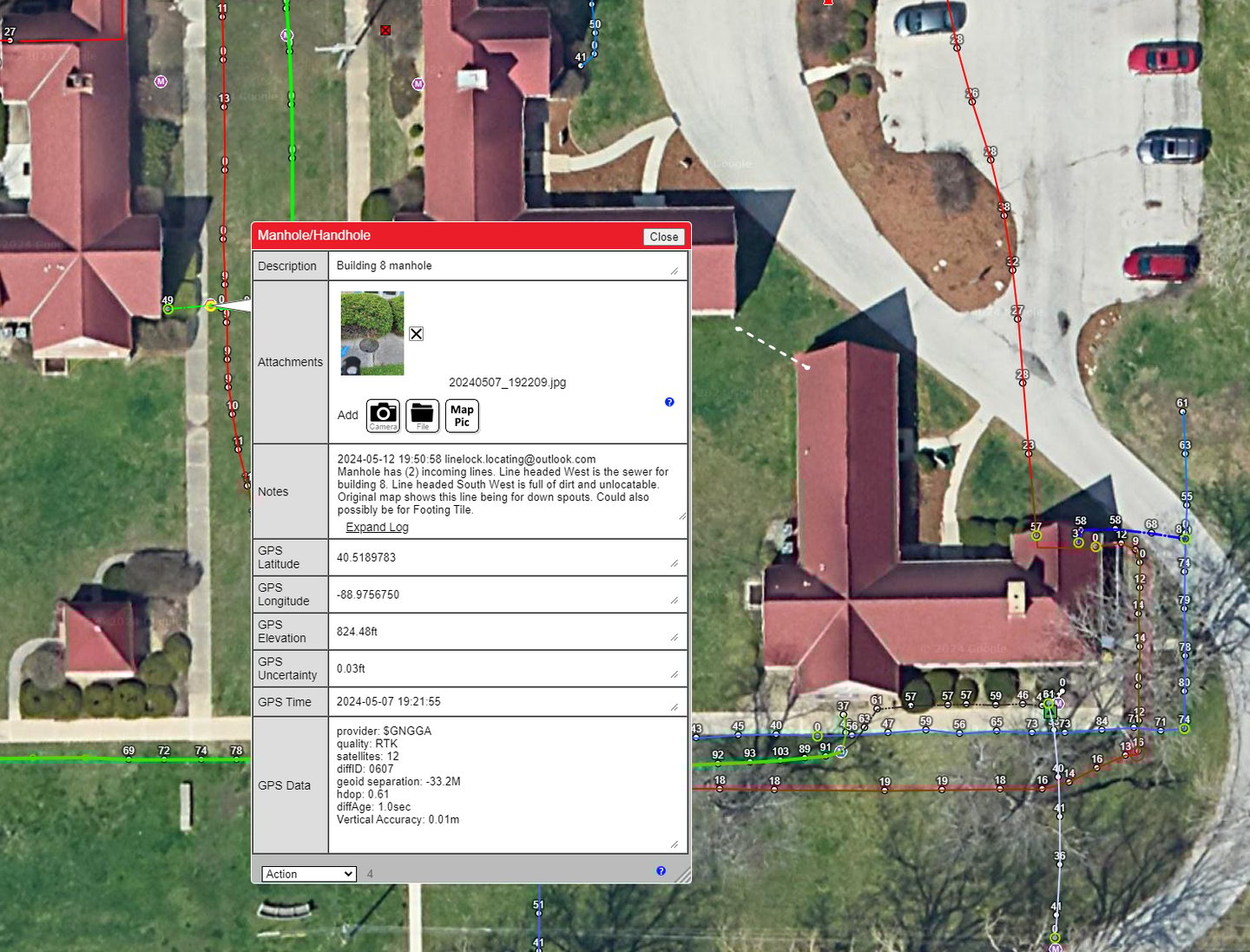
1. Access to Vital Data: GIS maps provide essential information that can be accessed during the project and for years afterward, ensuring ongoing reference and utility management.
2. Enhanced Decision-Making: With detailed field notes and real-time data, consumers can make informed decisions throughout the project lifecycle.
3. Picture and File Attachments: The ability to attach images and documents allows for a clearer understanding of the project context and conditions.
4. Accurate GPS Coordinates: GIS mapping provides precise GPS coordinates, facilitating accurate location tracking of utilities.
5. Time of Locate Tracking: Consumers can view when utilities were located, aiding in planning and historical reference.
6. Geode Accuracy: Our mapping offers GPS to Geode accuracy, ensuring the highest level of precision for utility placements.
7. Improved Safety: Access to accurate utility information minimizes the risk of accidents during construction or maintenance activities.
8. Long-Term Utility Management: With comprehensive mapping data, homeowners can efficiently manage their utilities over time, addressing any future concerns proactively.
9. Streamlined Communication: Clear, accessible maps enhance communication between homeowners, contractors, and utility providers, fostering collaboration and efficiency.


RTK Accuracy on all GIS Maps!
Want a physical print copy? No problem! We can provide large print files up to 48 x 36 inches. Elevate your construction, landscaping, or room additions with our detailed and accurate GIS maps, designed to enhance your projects and ensure precision every step of the way.
What is RTK?
RTK (Real-Time Kinematic) accuracy refers to high-precision positioning technology that uses satellite signals to deliver precise location data. By correcting signal errors in real time, RTK provides sub-centimeter accuracy (about 3/8 of an inch), making it ideal for applications such as surveying, construction, and utility locating.
This level of precision ensures projects are executed with exceptional accuracy, reduces the risk of costly mistakes, and improves overall efficiency. With RTK accuracy, you can confidently rely on your mapping and locating services to deliver the exact information needed for successful project outcomes.
Thats less than 3/8 of an inch!
To schedule an appointment!
GIS Mapping
Unlock precision like never before with GIS mapping powered by RTK accuracy - where every inch and every detail matter!
Utilities & Infrastructure
Storm and sewer manholes
Curb inlets and catch basins
Water main valves and curb stops
Fire hydrants
Irrigation lines and field tile drainage
Geothermal systems
Gas, electric, and communication lines
Septic tanks and leach fields
Underground storage tanks
Land & Property Features
Trees and landscaping assets
Cemetery plots
Fences and property boundaries
Retaining walls and drainage ditches
Ponds, wells, and water features
Access & Site Assets
Parking lot drains and light pole bases
Sign foundations and bollards
Gate posts and access systems
Utility poles
Agricultural & Specialty
Crop drainage systems
Underground irrigation mains and laterals
Livestock watering systems
Farm/ranch fuel lines
Buried storage structures
If it's in the ground, we can map it!
GIS Mapping has endless possibilities!
With GIS mapping, almost anything placed under the surface can be recorded with precision. Here are some examples to get you thinking:
Linelock Locating, LLC
Expert utility locating, leak detection, sewer camera inspections, GIS Mapping, and specialized water line locating with advanced technology.
Helping homeowners, contractors, and municipalities make informed decisions with accuracy and confidence.
Call for an Appointment!
Honest and Reliable
Proudly Serving Central Illinois
Privately Owned and Operated
(309) 826-2922
© Linelock Locating, 2025. All rights reserved.
Content and materials on this website are the property of Linelock Locating and may not be reproduced without permission